Urlaub 2022
Nach den schlechten Erfahrungen in 2018, sind wir in diesem Jahr doch noch einmal nach Kreta geflogen.
Mit unserer Unterkunft im Haus Dorothea hatté es leider nicht geklappt, sodass wir erstmalig in einem Hotel waren.
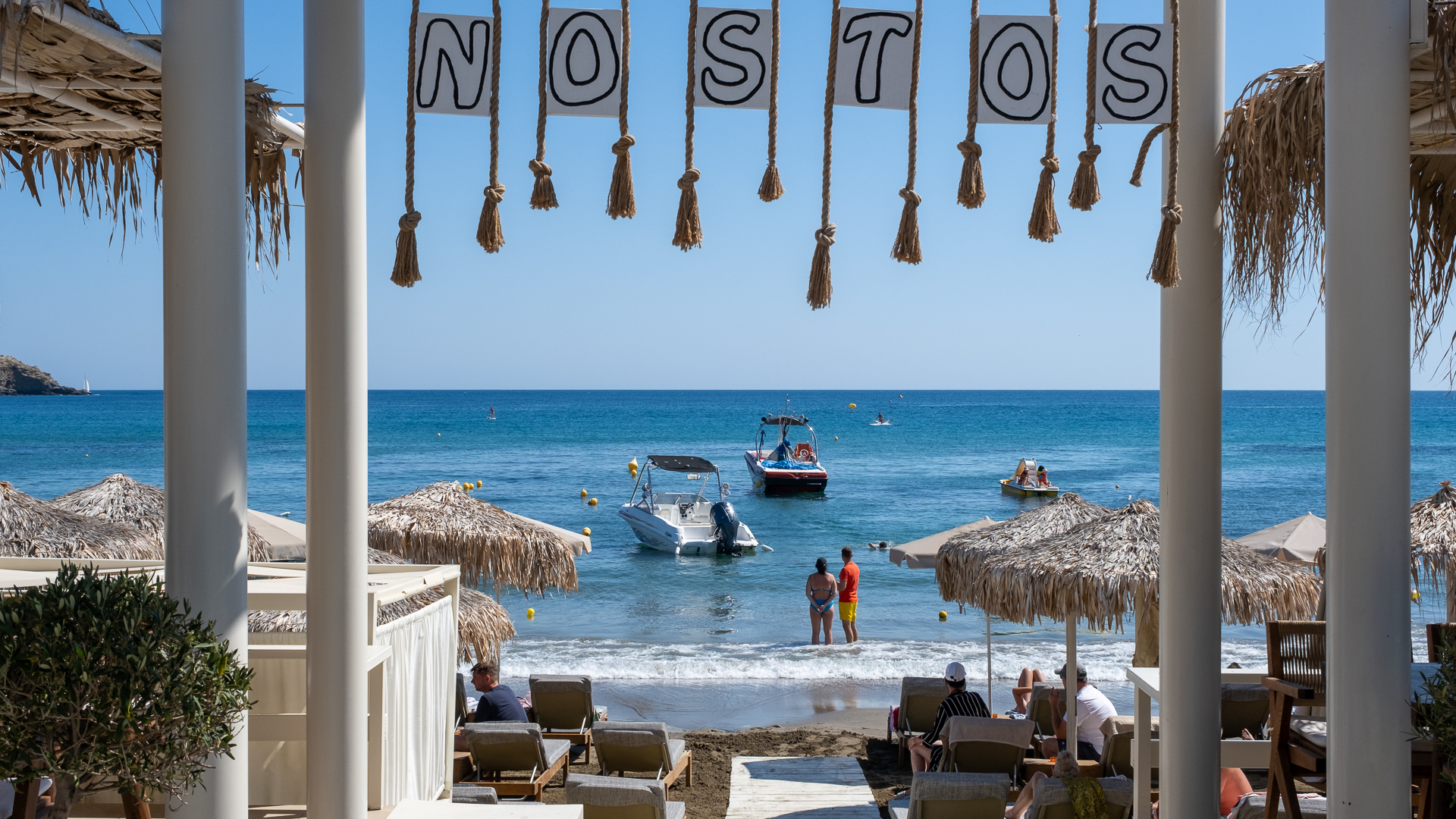
Das Hotel "Golden Beach" liegt in Adelianos Kampos direkt am Strand und hat uns gut gefallen. Unser Zimmer, ausgestattet mit Klimaanlage und Kühlschrank, lag im Souterrain und hatte eine kleine Terrasse. Von dort aus konnten wir direkt an den Pool oder Strand.
Wir hatten Halbpension gebucht, waren also morgens und abends verpflegt. Sowohl Frühstück als auch Abendessen (sofern wir nicht mit Freunden im Restaurant waren) war reichhaltig und schmackhaft.
Wie bereits in all den Jahren zuvor, waren wir vormittags mit unserem Jimny unterwegs und haben den Nachmittag am Pool verbracht. Baden im Meer war in den 3 Wochen kaum möglich, da eine steife Nordbrise für einen Wellengang sorgte, der das Hissen der roten Fahne bedingte. Uns hat es nicht gestört, viele andere Gäste waren sehr enttäuscht.
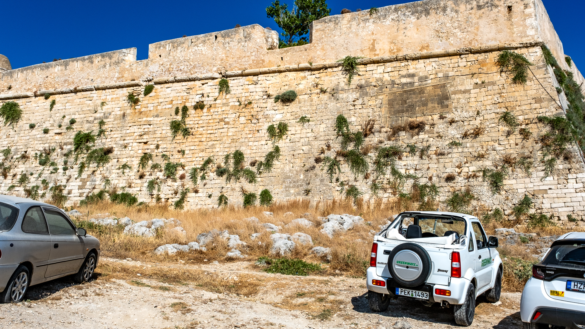
Fortezza
Wir waren nicht das erste Mal auf der Festung, aber irgendwie habe ich es wohl jedes Mal verpasst, ein paar Aufnahmen zu machen. Das habe ich jetzt nachgeholt.
Die Fortezza von Rethymno (griechisch Φορτέτζα του Ρεθύμνου) ist eine Festungsruine innerhalb des Stadtgebiets von Rethymno an der Nordküste. Sie ist eines der Wahrzeichen des Hauptortes des Regionalbezirks Rethymno. Die Bezeichnung Fortezza stammt aus der Zeit der Herrschaft der Republik Venedig über Kreta und bedeutet im Italienischen ‚Festung‘, die griechische Entsprechung für Festung ist Frourio (φρούριο) oder Kastro (κάστρο).
(Quelle: Wikipedia)
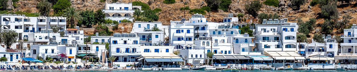
Plakias

Plakias (griechisch Πλακιάς) ist ein kleiner, aber touristisch bedeutsamer Ort an der Südküste. Er gehört zum Gemeindebezirk Finikas, der 2010 neu geschaffenen Gemeinde Agios Vasilios im Süden des Regionalbezirks Rethymno. Die Anzahl dauerhafter Einwohner beläuft sich auf etwa 325 (Volkszählung 2011). Noch in der Volkszählung des Jahres 1961 wurde Plakias als Wohnort von nur sechs Fischerfamilien erwähnt.
Verwaltungsmäßig wird Plakias als zwei Orte in den Statistiken geführt: der westliche Teil mit 143 Einwohnern gehört zu Sellia (Σελλιών Πλακιάς), der östliche mit 182 Einwohnern zu Myrthios (Μυρθιανός Πλακιάς)[1]. Der Ortsname Plakiás bezieht sich auf die in manchen Teilen der Bucht über oder unter Wasser zu findenden Sandstein-„Platten“ (auch als Naturzement bezeichnet).
(Quelle: Wikipedia)
Argiroupolis
Argiroupolis fahren wir in jedem Urlaub an, um dort ein paar Avocado-Produkte für meine Frau oder für Freunde/Freundinnen zu Hause zu kaufen.
Argyroupoli (griechisch Αργυρούπολη) ist ein Bergdorf. Es gehört als Ortsgemeinschaft zum Gemeindebezirk Lappa der Stadtgemeinde Rethymno.
Der Name Argyroupoli bedeutet Silberstadt (argyros άργυρος ‚Silber‘ und poli πόλη ‚Stadt‘). Der Ort liegt auf einer Höhe von durchschnittlich 260 Metern über dem Meeresspiegel und hat 403 Einwohner (Stand: 2011). Nach der Zählung von 1981 waren zu dieser Zeit noch 453 Einwohner ansässig. Argyroupoli wurde auf dem Gebiet der antiken Stadt Lappa erbaut, von der an verschiedensten Stellen des Dorfes Fundstücke zeugen.
(Quelle: Wikipedia)
Iraklio
Ich fliege jetzt ich seit 1997 nach Kreta und lande immer in Iraklio, von der Stadt selbst hatte ich aber noch nichts gesehen. Das haben wir in diesem Jahr geändert und haben Kretas Hautpstadt besucht. Was soll ich sagen? Die Stadt ist aus meiner Sicht nicht zum Urlaubmachen geeignet. Eine Industriestadt, die nicht viel fürs Auge zu bieten hat.
Iraklio (Ηράκλειο), veraltet auch Iraklion, in seitens der Stadt selbst verwendeter Schreibung Heraklion, altgriechisch Ἡράκλειον, Herakleion, im Mittelalter Chandakas, in der Zeit der venezianischen Herrschaft Candia, danach türkisch Kandiye, neugriechisch Μεγάλο Κάστρο (Megalo Kastro)), ist die größte Stadt der Insel und der Sitz der Verwaltungsregion Kreta. Der Name leitet sich etymologisch ab vom Namen des Heros Herakles (siehe Geschichte). In wissenschaftlicher Literatur wird (selbst in neueren Texten) auch der Name Hieraklion (ableitbar von Hieron) verwendet.
Die Stadt liegt etwa in der Mitte der Nordküste der insgesamt 250 km langen und bis zu 70 km breiten Insel. Sie ist in einer Küstenebene vor einem fruchtbaren Hügelland direkt an einer Bucht der Ägäis gelegen, etwa vier Kilometer nördlich der Ruinen der minoischen Palastanlage von Knossos. Kreta, und damit auch Iraklio, ist von April bis Oktober ein hochfrequentiertes Touristenziel. Die Entfernung zu den anderen Städten Kretas beträgt 130 km nach Chania, nach Rethymno 75 km, nach Agios Nikolaos 60 km, nach Ierapetra 90 km und nach Sitia 120 km.
(Quelle: Wikipedia)
Margarites
Das Töpferdorf Margarites wird von uns im Urlaub immer mehrfach angefahren. In der Taverna "Mantalos" werden wir immer freudig begrüßt und sehr nett und reichlich bewirtet. Ein sehr schönes Fleckchen Erde.
Das Töpferdorf Margarites (Μαργαρίτες) ist ein traditionelles kretisches Dorf im Regionalbezirk Rethymno, zur Gemeinde Mylopotamos gehörend, das für seine Töpferwaren bekannt ist. In den zahlreichen Töpfereien wird viel Massenware, doch mehr noch individuelle Töpferkunst hergestellt. Etwas außerhalb des Dorfes stellt ein Töpfer sogar die großen altertümlichen Tongefäße (Pithoi) nach minoischem Muster her.

Mindestens ebenso interessant sind die vier oder fünf byzantinischen Kapellen, teilweise mit Fresken, und einige alte Gebäude in den schmalen Gassen des Dorfes. An der Hauptstraße liegt ein venezianisches Herrenhaus mit Ölmühle.
Vom unteren Dorfplatz führt eine schmale Gasse zu einem in den letzten Jahren restaurierten Kloster.
(Quelle: Wikipedia)
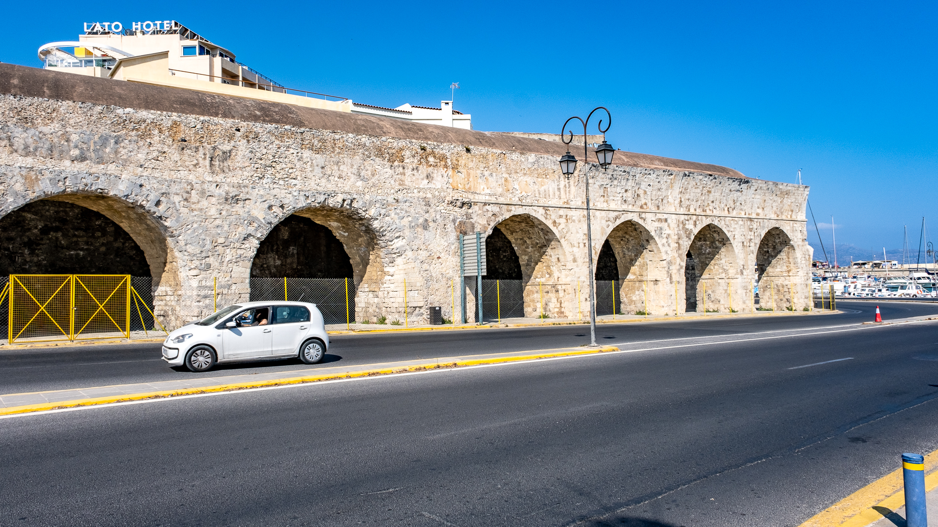
Rethymno

Rethymno (Ρέθυμνο, veraltet auch Rethymnon) ist eine Hafenstadt im Norden. Sie ist nach Iraklio und Chania die drittgrößte Stadt der Insel und bildet als gleichnamige Gemeinde (Δήμος Ρεθύμνης Dímos Rethýmnis) das Zentrum des Regionalbezirks Rethymno.
Neben Iraklio ist Rethymno einer der beiden Standorte der Universität Kreta, Standort eines staatlichen Krankenhauses und war bis Oktober 2008 auch Anlaufpunkt für Fährschiffe aus Piräus.
(Quelle: Wikipedia)
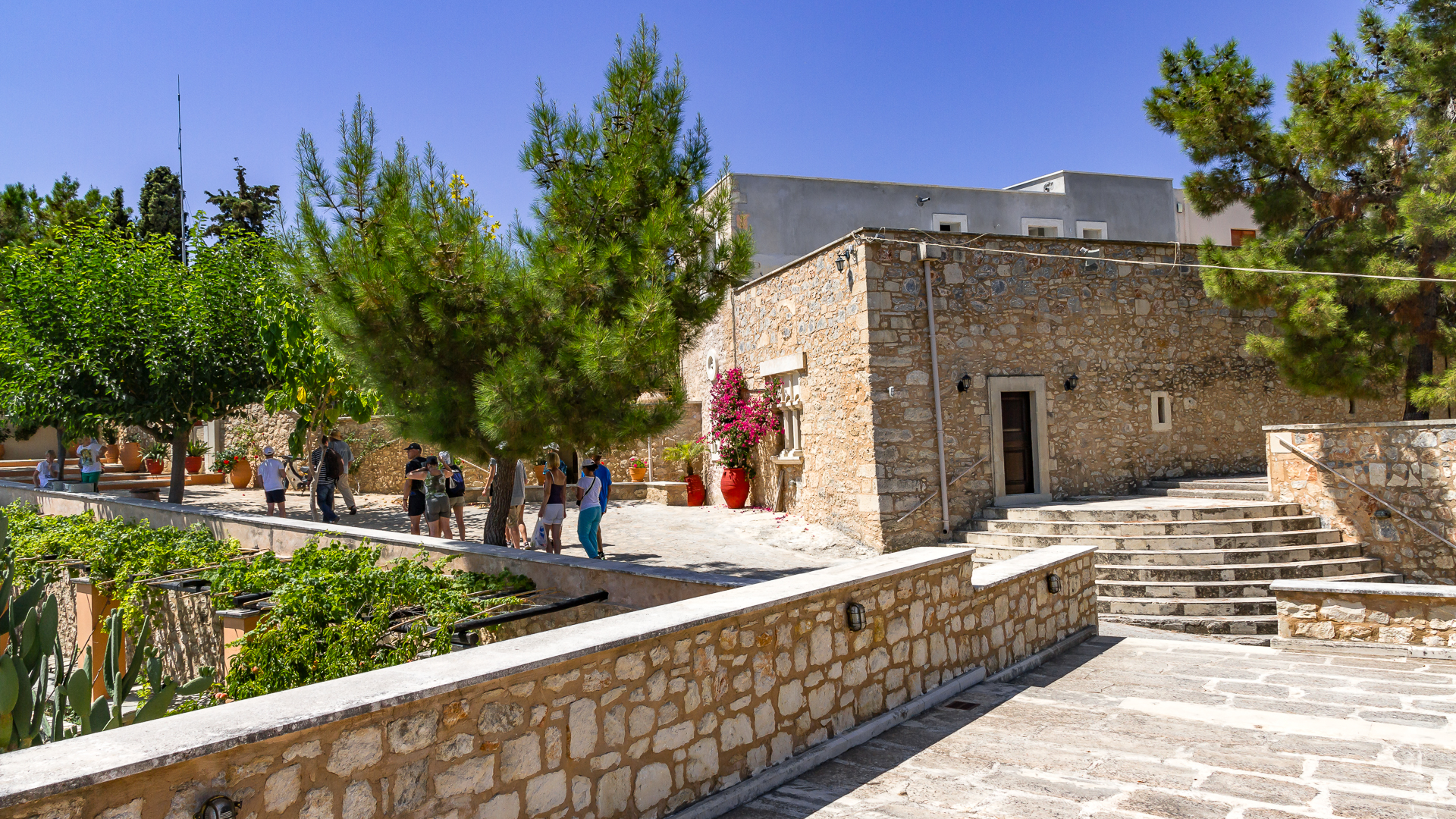
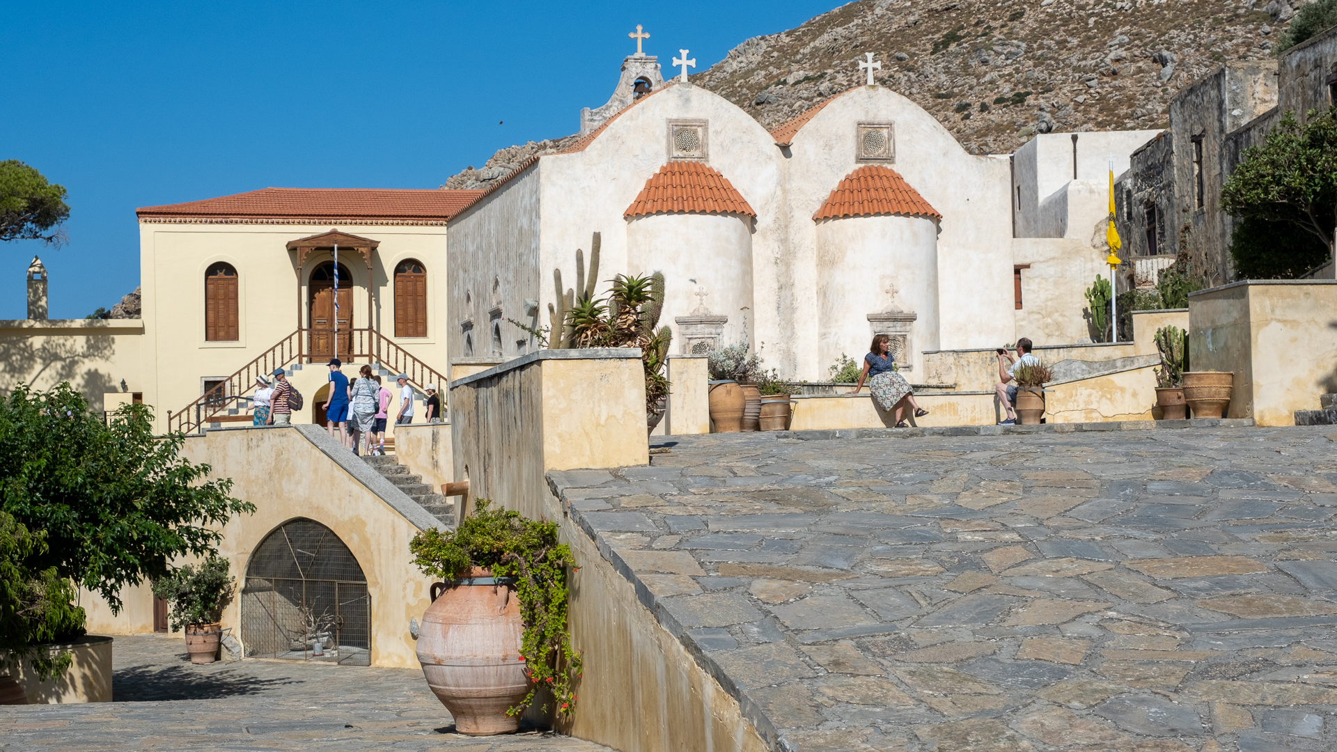
Kloster Agia Irini
Agia Irini (griechisch Αγία Ειρήνη ‚Heilige Irene‘) ist der Name einer Siedlung im Gemeindebezirk Rethymno der gleichnamigen Gemeinde im Norden Kretas. Sie befindet sich in 260 Metern Höhe am Fuß des Berges Vrysinas, rund vier Kilometer südlich des Stadtzentrums, direkt an einem Kloster der Heiligen Irene, nach dem die Ortschaft benannt ist. Sie wurde erstmals 1545 durch Francesco Barozzi schriftlich erwähnt. Agia Irini zählte 2011 insgesamt 75 Einwohner.
Die Abtei der Heiligen Irene wurde während der Aufstände gegen die osmanische Herrschaft 1866 zerstört und lag seitdem brach; im Jahr 1989 wurde sie restauriert und ist heute auch wieder bewohnt. Für die Restaurierung wurde 1995 der Europa-Nostra-Preis für den Erhalt kulturellen Erbes der Europäischen Union verliehen. Das Nonnenkloster beherbergt ein kleines kirchliches Museum. Außerdem werden Ikonen, Textilien und Handarbeiten der Nonnen zum Verkauf angeboten.
(Quelle: Wikipedia)
Chora Sfakion

Chora Sfakion (Χώρα Σφακίων) ist ein Küstenort im Süden der Insel Kreta mit einem kleinen Hafen am Libyschen Meer. Er hatte 2001 212 Einwohner und ist Hauptort der historischen Region und der heutigen Gemeinde (Dimos) Sfakia.
(Quelle: Wikipedia)
Balí
Bali (Μπαλί) ist ein Badeort im Gemeindebezirk Geropotamos der Gemeinde Mylopotamos an der Nordküste, ca. 50 km westlich von Iraklio und ca. 40 km östlich von Rethymno.
Ursprünglich ein kleiner Fischerort, weist Bali heute viele Hotel- und Pensionsneubauten auf. Der Ort verfügt noch über einen kleinen Hafen, in dessen Nähe sich auch mehrere Tavernen befinden, wo der von den Fischern aus Bali gefangene Fisch serviert wird.
(Quelle: Wikipedia)
Georgioupoli
Georgioupoli (griechisch Γεωργιούπολη, hochsprachlich Georgioupolis, Γεωργιούπολις) ist ein Ort an der westlichen Nordküste von Kreta im Regionalbezirk Chania, etwa 22 km von Rethymno, 35 km von Chania und 100 km von Iraklio entfernt. Die Ortschaft Georgioupoli hatte 2011 936 Einwohner, das Dorf selbst 455.
Bis 2010 war Georgioupoli auch eine selbständige Gemeinde mit etwa 2500 Einwohnern. 1997 durch Eingemeindungen vergrößert und zur Stadtgemeinde (Dimos) erhoben, wurde sie zum 1. Januar 2011 einer von sechs Gemeindebezirken der neu geschaffenen Gemeinde Apokoronas.
Georgioupoli wurde 1893 als Almiropolis gegründet und 1899 zu Ehren des damaligen Hochkommissars von Kreta Georg von Griechenland in Georgioupoli umbenannt. Um die ursprüngliche Moorlandschaft zu entwässern, wurden Anfang des 20. Jahrhunderts zahlreiche Eukalyptusbäume gepflanzt. Eine eindrucksvolle Allee von Eukalyptusbäumen empfängt daher heute den Besucher und prägt das Ortsbild.
Der Ort liegt in der Rundung einer Bucht vor einer westlich vorspringenden Halbinsel in einer mit Eukalyptusbäumen gesäumten Flussniederung. Der Strand von Georgioupoli besteht größtenteils aus feinem Sand, erstreckt sich über 10 km gen Osten. Etwa fünf Kilometer landeinwärts befindet sich der einzige natürliche Süßwassersee auf Kreta, der Kournas-See.
Man erreicht von Georgioupoli aus schnell die zwei größeren Städte Chania und Rethymno. Auch Vamos und Kalyves sind von dem kleinen Ort nicht weit entfernt.
Der Ort hat einen kleinen Fischerhafen, der von dem etwa einen Kilometer kurzen Fluss Almiros (dt. ‚der Salzige‘) gespeist wird. Im Wasser des Flusses sind unter anderem Wasserschildkröten heimisch.
Georgioupoli ist stark durch den Pauschaltourismus geprägt. Sowohl im Ortsgebiet als auch östlich davon entstanden zahlreiche Hotelanlagen sowie eine vom Tourismus abhängige Infrastruktur mit Läden, Gastronomiebetrieben, Immobilienbüros und Autoverleihfirmen.
(Quelle: Wikipedia)
Moni Preveli
Das Kloster Preveli (Μονή Πρέβελη) ist ein Mönchskloster (gr. Μοναστήρι, Monastiri) im Süden der griechischen Mittelmeerinsel. Es befindet sich in der Gemeinde Agios Vasilios des Regionalbezirks Rethymno.
Das Kloster stellt einen religiösen Mittelpunkt der Diözese „Lambi, Syvritos und Sfakia“ dar. Es gehört der halbautonomen Kirche von Kreta an, die dem Patriarchen von Konstantinopel unterstellt und seit 1913 mit der Kirche von Griechenland assoziiert ist. So weht neben der griechischen Flagge auch der doppelköpfige byzantinische Adler auf goldenem Grund im Innenhof der Klosteranlage. Das Engagement der Mönche für Freiheit und Unabhängigkeit der griechischen Einwohner Kretas sowie für schulische Weiterbildung, begründete den überregionalen Ruf des Klosters.
(Quelle: Wikipedia)
Agia Galini

Agia Galini (Αγία Γαλήνη) ist ein Küstenort am Golf von Messara, 24 Kilometer südöstlich von Spili. Zusammen mit dem Dorf Xirokambos bildet er eine Ortsgemeinschaft in der Gemeinde Agios Vasilios.
Dank seiner malerischen Lage hat sich Agia Galini ab Ende der 1970er- und in den 1980er-Jahren von einem kleinen Fischerdorf zu einem Zentrum des Pauschaltourismus entwickelt und verfügt seitdem über zahlreiche Hotels, Pensionen, Tavernen, Bars und Diskotheken sowie einen Campingplatz. Wie in vielen touristischen Zentren, findet man in Agia Galini eine so genannte Fressgasse, in der sich eine Taverne an die andere reiht. Der Hafenplatz, mit seinen am Hang hinaufgestaffelten Hausfassaden, gilt dagegen als einer der schönsten Griechenlands. Agia Galini ist auch ein günstiger Ausgangspunkt für Touren ins kretische Hinterland, beispielsweise in das Gebirgsdorf Zaros mit der einzigen Forellenzucht der Insel, in die Rouvas-Schlucht oberhalb von Zaros oder das Amari-Becken. Neben dem Strand in Ortsnähe, bieten sich für Badeurlauber die nahe gelegenen Strände von Agios Georgios und Agios Pavlos an, die am besten mit Ausflugsbooten oder Mietwagen zu erreichen sind.
(Quelle: Wikipedia)
Potamon Staudamm
Der Potamon-See (Λίμνη Ποταμών = Limni Potamon) ist ein Stausee in der Nähe von Rethymno. Er stellt die Wasserversorgung der Stadt Rethymno und ihrer Umgebung sicher.
Er ist der größte Süßwasser-See Kretas.
Der See befindet sich in einer Entfernung ca. 14 km Luftlinie südöstlich von Rethymno in der Nähe der Dörfer Prasses und Voleones am Ausgang des fruchtbaren Amari-Tals.
Der See hat eine Fläche von 16 Quadratkilometern, seine maximale Tiefe beträgt 54 Meter. Das Speichervolumen beträgt 22,5 Millionen Kubikmeter. Der Stausee hat eine Uferlänge von zwölf Kilometern.
(Quelle: Wikipedia)

Loutro

Loutro (Λουτρό) ist ein Dorf in der Gemeinde Sfakia an der Südwestküste der Insel. Loutro gehört zur Kinotita Anopoli.
Der Ort liegt zwischen Chora Sfakion und Agia Roumeli am Fuße der Weißen Berge. Es hat bis heute keine Straßenverbindung. Die Fähren der Anendyk, die die Touristen aus der Samaria-Schlucht zum Busbahnhof in Chora Sfakion bringen, fahren das Dorf im Sommer regelmäßig an, in der Hochsaison sogar mehrmals täglich. Von Juli bis September verkehren zudem Taxiboote zu den nahe gelegenen Stränden Glyka Nera im Osten (1 Stunde Fußweg) und Marmara (1,5 Stunden Fußweg) im Westen. Außerdem ist Loutro über den Europäischen Fernwanderweg E 4 zu Fuß zu erreichen. Man wandert in 2 Stunden bis Chora Sfakion und in 6 Stunden bis Agia Roumeli. Ein Anfang des Jahrtausends restaurierter Kalderimi führt in Serpentinen nach Anopoli und Kambia auf der Hochebene von Anopoli in knapp 700 m Höhe (Aufstieg ca. 2, Abstieg ca. 1,5 Stunden). Dieser ist allerdings im Jahre 2007 teilweise durch Zäune und eine Hirtenpiste verbaut worden und die Verbindung nach Kambia ist für Ortsfremde nicht mehr zu finden. Von Anopoli ist der weitere Aufstieg auf den Pachnes möglich.
(Quelle: Wikipedia)
Anogia
Anogia (Ανώγεια) ist eine Gemeinde (Δήμος, Dimos) im Nordosten des Psiloritis-Massivs im Regionalbezirk Rethymno, einer der 13 Regionen Griechenlands. Die heutige Gemeinde Anogia ist eine der wenigen griechischen Gemeinden, die durch das Kallikratis-Gesetz aus dem Jahr 2010 unverändert blieb. Bereits 2006 waren die 1997 nach Anogia eingemeindeten Dörfer Axos und Zoniana ausgegliedert worden: Axos kam zur Gemeinde Kouloukonas, Zoniana wurde eine eigenständige Landgemeinde. Kouloukonas und Zoniana wurden 2010 in die neue Gemeinde Mylopotamos eingegliedert. Laut der Volkszählung vom Jahr 2011 lebten zu diesem Zeitpunkt insgesamt 2379 Einwohner ständig im Gemeindegebiet, davon 2.319 in Anogia selbst sowie 60 in dem Weiler Sisarcha.
Die Gemeinde Anogia befindet sich an der Ostgrenze des Regionalbezirks Rethymno zum Regionalbezirk Iraklio. Sie grenzt im Nordwesten an die Gemeinde Mylopotamos, im Nordosten an Malevizi, im Süden an Festos und im Südosten an Gortyna.
Anogia ist 54 Kilometer von der Regionalbezirkshauptstadt Rethymno entfernt und liegt südöstlich an der Straße Rethymno – Panormo – Perama – Anogia. Die Entfernung zur Inselhauptstadt Iraklio beträgt 36 Kilometer. Nach Iraklio führt die Straße über Sklavokambos und Tylisos. Im Süden des Gemeindegebietes befindet sich die Nida-Hochebene mit der Idäischen Grotte. Aufgrund der abgeschiedenen Lage haben sich lokale Bräuche, Trachten und ein starker Dialekt erhalten.
(Quelle: Wikipedia)
